

Mostrunde
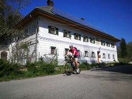


- Suitable for families
- Suitable for pushchairs
- Flatly
Interactive elevation profile
Create PDF
Tour-Details
Path number: 22
Starting place: 4643 Pettenbach
Destination: 4643 Pettenbach
duration: 1h 2m
length: 15,8 km
Altitude difference (uphill): 51m
Altitude difference (downhill): 53m
Lowest point: 443m
Highest point: 474m
difficulty: easy
condition: easy
panoramic view: No view
Paths covering:
Asphalt, Gravel
powered by TOURDATA
Haltstraße - Welser Straße - Enengl (Almtal Camp) - Bergsleithenstraße
- Weidenhaidstraße - Eberstalzeller Straße - next junction left
Turn left - Gramös/Schallaun - Zeitlhubstraße - Eggensteinstraße
- Sattelmühlestraße to and through Pfaffing - Pfaffing
- Wasserhubstraße - follow R11 into Bergsleithenstraße - Wilflingstraße - train stop
Wilflingstraße - Wilfling train stop or continue via Haltstraße
- Welser Straße - Enengl - to the Almtal Camp - Florianistub'n.
- Suitable for groups
- Suitable for pushchairs
- Suitable for single travelers
- Suitable for families
- Suitable for friends
- Suitable for couples
- Suitable for children
- Spring
- Summer
- Autumn
- Early winter
Please get in touch for more information.
Im Dorf 17
4645 Grünau im Almtal
Phone +43 7616 8268
Fax machine +43 7616 8895
E-Mail gemeinde@pettenbach.ooe.gv.at
Web traunsee-almtal.salzkammergut.at
Web www.pettenbach.at/
https://traunsee-almtal.salzkammergut.at
https://www.pettenbach.at/
https://www.pettenbach.at/
Interactive elevation profile
Create PDF
Tour-Details
Path number: 22
Starting place: 4643 Pettenbach
Destination: 4643 Pettenbach
duration: 1h 2m
length: 15,8 km
Altitude difference (uphill): 51m
Altitude difference (downhill): 53m
Lowest point: 443m
Highest point: 474m
difficulty: easy
condition: easy
panoramic view: No view
Paths covering:
Asphalt, Gravel
powered by TOURDATA